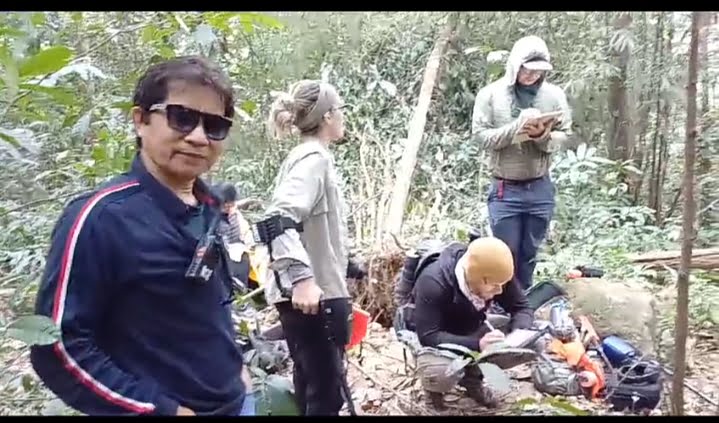
Diphu February 7 2024: As of recent past, a group of an outsourced entity named PalaeoWest sent in to investigate a possible World War-II military plane wreckage finished its work of scouring the location identified on the steep grounds of the northern side of the Karbi Hills Massif.
The mission lasted a quiet five days or so completed by tight-lipped mission members, refusing to divulge anything about their findings. Their papers were in order, right from the Ministry of External Affairs, the General Administrative Department, Government of Assam and the local administration headed by the Deputy Commissioner of District of Karbi Anglong.
Little did anyone suspect about a serious security lapse, in most possible way involved in this caper. It is like travelling into the fourth most powerful nation in the world with a false identity.
A year ago, 2023, acting on a request from an agency of the Government of India, a diligent department of the Karbi Anglong Autonomous Council located the wreckage of a plane, presumably of the Word War-II era.

Research team investigates the military plane wreckage.
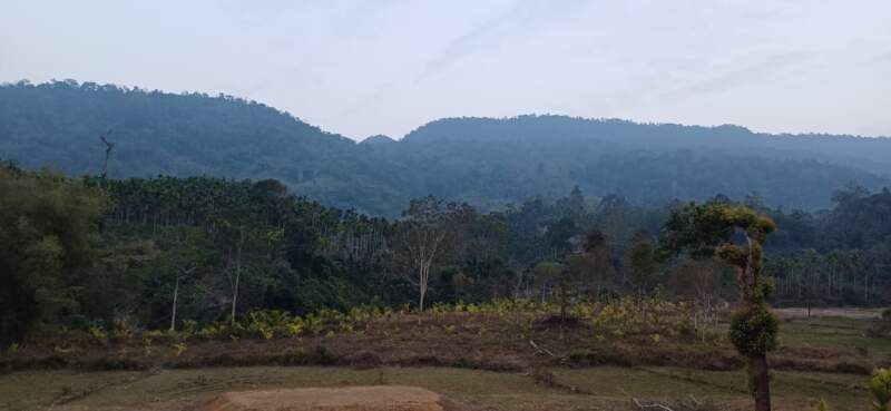
The area is on the eastern aspect of a small segment of steep area named Ram-Sita Pahar/Parbat. The boys did a good job returning with photographic records bearing geographical coordinates that would later be found in the Survey of India’s map 83F of a metric small scale.
Ostensibly, the search was on for the missing plane downed during the time Assam became a staging base for the counter-offensive against the Japanese in the China Burma India (CBI) theatre of war in the Indo-Pacific areas. The skies were full of airplanes buzzing to and from Kunming and the Hump Flying Bases like that of Dinjan, Sookerating, Ledo, Rowriah and so on.
They carried on one of the greatest on the wing supply missions in that Hump Operation with losses mounting over 600 planes and many persons still reported missing. The routes were Easterly, Westerly and both ways and went by code names viz. Nan, Able and Oboe and so on.
But to lose flying assets in the central Assam Hills feature named then as Mikir Hills Massif (MHM) corrected to Karbi Hills Massif (KHM) is another matter or so it seems.

The crash area.
The Aviation Map by the Survey of India of the Eastern airspace of India marks this area as VER 87(C ), a restricted area for over-flying though the maximum elevation of two features is not beyond five thousand feet only, nothing big in aviation terms.
So, the team went on searching for the plane who’s corresponding MACR or the Missing Air Crew Report number 14165. But that happened to expose the chink in the armor of the agencies that matter. The MACR belongs to a plane gone missing in Germany:
Fig. 1 shows the fact through a search function in Open Sources. How could this gaffe not be detected by the MEA though the process is understood to have gone a period of one year’s incubation is not understood?
Meanwhile, an unconfirmed watcher reports that amongst the recoveries, at least six human skeletal fragments were found and taken off the ground. Why did the US agency have to use such wrong information to gain access to ground that can have a view of the alleged Surface to Surface Missile, AGNI base at Misa, a former WW-II airfield?
According to the available and knowledgeable sources, the area in question has some home to abundant Beryl and Barite stones, an indicator of Radioactive Minerals.
The whole issue unfolded with an approval from the Government of India regarding the U.S. Government’s Defense Prisoners of War/ Missing in Action Accounting Agency , regarding missions to be undertaken in Assam from 22-31 Jan 2024 and Meghalaya from 01-10 Feb 2024.
The US Government’s appointed private company ‘PaleoWest’ undertook the two missions on government’s behalf. The Assam and Meghalaya Government ensured the US delegations activities within the specified area
Sites located in Missing Aircraft Crew Report [MACR] 14165 near Kaipani Village. Karbi Anglong District, Assam, India at 26 degrees 27.30 minutes north. 93 degrees 10.35 minutes East (MGRS 46R EQ 1783 26455, WGS 84)
Sites in Missing Air Crew Report ([MACR] 6603 located near Borhill Falls, East Khasi Hills District, Meghalaya, at 25 degrees 10.965 minutes North, 91 degrees 57.448 minutes East.
The US delegation was allowed to investigate each site for establishing a datum for future recovery operations at the sites suspected of containing the remains of U.S service members missing in action from World War II.
It may be noted that as per the Memorandum of Agreement signed between DPAA and the Anthropological Survey of India in 2023 regarding the storage and handling of remains, the Government of India should be notified and provide complete details of any human remains recovered during the activity.
The remains discovered are to be transported to Anthropological Survey of India office in Kolkata to conduct standard Joint Forensic Review Anthropological Survey of India would document all material before allowing the remains to be transferred to the US Consulate in Kolkata after receiving Govt. of India’s final approval.

Wreckage investigation team
