
A psychoanalysis of geopolitical development on Indo-Myanmar relations and Manipur, Nagaland, Arunachal Pradesh, Assam in situational whirlpool, muck and mess; Mizoram as the unexpected Prima Donna.
The geostrategic location, natural resources of strategic importance, the physiography all combined imparts a unique distinction of geopolitics of India’s North Eastern Landscape.
The Second World War established this beyond any doubt. The erstwhile undivided Assam as well as the un-administered area turned into a staging ground for counteroffensive in the China-Burma-India theatre of WW-II.
The area also had an access to the sea, the Bay of Bengal, making it quite potent in the geostrategic terms. This access has become the National Waterway-II aka the river Brahmaputra.
The Bengal and Cachar boundary award leading to the establishment of the Radcliffe line created East Pakistan. And the NE landscape acquired an unfriendly neighborhood.
The steamer services, from Dibrugarh via Tezpur, Guwahati and Dhubri to Gualonndo went out of commission.
The Siliguri Chicken Neck was a product of partition of India. Due to socio political and economic developments in the NE sectors the same became too dependent on the supply line across this corridor providing geographical connectivity with mainland India.
China Friction
With the constant friction with China, the landscape turned vulnerable, having to depend upon the Chicken Neck corridor. This corridor is necessary for both civilian and military point of view.
With the recent developments in Bangladesh, the vulnerability of the corridor, which is only 22 kilometers wide at the maximum, has increased multifold.
During the recent visit to the People’s Republic of China by the Premier of Bangladesh, the PRC leaders impressed upon him that they conceded the military base at Lalmonirhat.
This is located too close for comfort for Shillong, Guwahati, Tezpur. If a squadron of Chinese war planes was to operate from there, the endgame of the Sino-Indian armed showdown would certainly go in favor of China. India needs, in such a case, to deny access to China at all costs.
The Rangpur Division, according to some, needs to be annexed, which is located just south of the Chicken Neck boundary. Similarly, the Chittagong Hills Tract and parts of Sylhet Division, it is advocated, need similar proactive treatment.
In the first case, the Siliguri Chicken Neck would be much wider, shorter and the terrestrial connectivity with NE Indian landscape would be safer. The Army and IAF would also stand to benefit.

India chicken neck map
In the latter case; with the annexation of the Chittagong Hill Track, the land-locked NE India will get access to the port facilities. With Sylhet in pocket, the landlocked and arduously connected Barak Valley would be easily connected to the rest of NE India.
Steamy and Hot Undercurrent
However, a steamy and hot undercurrent is on in Nagaland, Manipur and parts of Arunachal Pradesh (Changland and Tirap.)
In Nagaland, of late, there are 28 insurgency related outfits running their affairs. Only five of them want to be in the settlement process through negotiations (so called Pro-Talk). NSCN-(IM) has been holding talks with the Central Government and Government of India has given importance to this overture.
The NSCN-K (Khaplang) faction still proves to be a hardliner and refuses to come to the discussion table. NSCN-IM and its claim for an extended and unified Nagaland is causing head-ache for the South Block in New Delhi.
The boundaries of this claimed territory is beyond the state of Nagaland and intrudes into Assam, Manipur, and Arunachal Pradesh in India. And internationally, Nagalim demand seeks to take in areas inside Myanmar inside the Kachin State and Chinland of Sagaing Division.
Burma – India Boundary
The Burma – India Boundary has been delimited in great detail by a bilateral treaty signed on March 10, 1967, and ratified shortly thereafter.
Demarcation will be the subject of a separate agreement to be negotiated in the near future. The 1967 boundary follows the “traditional” line between the two states while rendering with precision two formerly indefinite areas.
Almost 60 percent of the 872-mile long boundary follows water divides, both major and minor, while nearly one-third coincides with median lines of frontier streams and rivers. The remainder of the border comprises a straight line between previously established boundary pillars.
The frontier area topography varies from low mountains in the south to high ridges and peaks in the north, adjacent to the Himalaya. As a result, the region is one of low population density and of reduced economic development.

Assam Burma China Pipeline
Burma Separation
The Government of India Act separated Burma from India by defining the former as “…all territories which were immediately before the commencement of Part II of this Act comprised India, being territories lying to the east of Bengal, the State of Manipur, Assam, and tribal areas connected with Assam….” “Burma shall cease to be a part of India….”
After World War II, Burma and India as well as Pakistan gained their independence from the United Kingdom. No Burma – India boundary was specified in the independence acts; resolution of the border was left to the newly independent governments.
However, there remained a Free Movement Regime beyond the boundaries which would come to end with the effective fencing of the difficult boundary conditions. This enabled various rebel groups to set up camps in Myanmar.
Liberation of Bangladesh
During the liberation of Bangladesh war in 1971, the Mizo and Naga rebels were fighting along with the soldiers of the Pakistani Army in the Chittagong Hill Track.
The PLA and ISI had set up the training bases for them in CHT of erstwhile East Pakistan. With the coming up of a friendly regime in nascent Bangladesh, they were forced to shift to alternative locations.
The Multi Mode Kaladan Project in Mizoram connects the port of Sittwe in Myanmar. The railway line linking Bairabi and to the innards of Mizoram state is about to be commissioned. Therefore, the Mizoram government felt it necessary to introduce the ILP system.
A delegation from Government of Mizoram is soon visiting Arunachal Pradesh to learn and develop a site specific effective model for implementation of ILP in Mizoram.
And this has probably prompted the Government of Assam to go for a parley with the Government of Mizoram for a talk on Assam-Mizoram Boundary affairs very soon.
If the dream of Nagalim to access the areas inside Myanmar is spoiled by the border fencing, Mizoram has another story to tell.
The present Chief Minister of Mizoram took an initiative to unify two warring groups of Chinland. An agreement was inked in this regard in Aizawl town last month.
But this would come at the cost of ceding their area across the boundary with Mizoram. This would be a good way to get the Kaladan Project going in fine fettle.
An old politician labeled the NSCN factions as the mother of all insurgency activities in north east India.
Despite the bravado it is putting up, it is reportedly undergoing difficulties. NSCN-IM enjoys a lot of ground support from the masses of Nagaland.
Partitions
The fissiparous tendencies of the Hilly area which are predominantly Christianized; originates from what is known as Reid’s Crown Colony Scheme of 1942.
Reid argued that if India is supposed to be partitioned on the lines of Hindu and Muslim, then the denizens of the Hills on the basis of Christianity have to be given a chance under a unified area.
This area proposed included the Garo, Khasi and Jaintia, Mikir Hills, Naga Hills, Lushai Hills, Manipur, the un-administered area under various frontier divisions and the tribal areas of north Burma (now, Myanmar).
The valleys of the Brahmaputra and Barak were obviously shunned. As for the former Princely State of Manipur which was annexed with India in 1946, there are claims and counterclaims and even fabrication of historical facts.
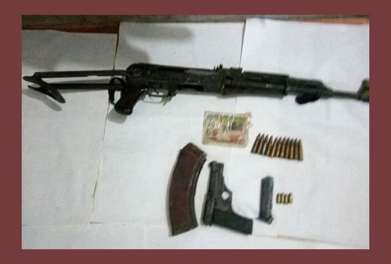
As the Indian state of Manipur enters a second year of trouble torn times, the effect of gun running and narcotic terrorism seem to surface.
Manpur has terrestrial connectivity with Myanmar through Moreh and by Imphal Tiddim Road. The Look East Policy of the Government of India needs them badly. So the steamy and hot weather is in the East.


