Problems of Boundary Disputes
Diphu July 9: Unified India is the gift of the British Colonial rule of the most diverse tract in the world. The job of running Independent and Democratic India must be the most difficult one in the contemporary globe in a politico-economic context. Internal boundary clashes continue in North East India.
The gradual annexation of the valleys of the Brahmaputra (that was ruled by the Ahoms) between 1822-1826 in the wake of the Industrial Revolution, pushed the eastern boundary of British Bengal further to the north east.
By 1874, the gamut of territorial occupation comprising the valley of the Brahmaputra and Sylhet, to be known as the new Commissariat of Assam became a landmark of geopolitical development of the tract.
The expansions like the annexation of Assam (1826-1856), followed by another annexation process of the Bengal(eastern part) and Assam Dooars (Kamrup and Darrang), separation of Bengal (1905) and laying of the Mac Mohan Line (1914) had a profound influence on the expansion and redrawing of the boundary of the area; underlying the ever-present flux of adjustments.

Brahmaputra river. Image by Bishnu Sarangi from Pixabay
Causes of Boundary Disputes
Annexation
The occupation or annexation of the Valley of Brahmaputra, principally occupied for about six hundred years by the Ahom Rulers, could not be an accidental one. It was a militaristic response to the imperialist expansionist plan of the Burmese.
As the first Anglo Burmese war, culminating in 1826 with the signing of the Peace Treaty of Yandabo; the militaristic experience proved too heavy on the crown economy of colonial India. It was the most expensive war ever fought (19 million pounds sterling).
Half of the colonial manpower perished due to diseases peculiar to the tract. The expulsion of the Burmese took place in the three sectors: Up Goalpara to Guwahati and Nagaon to Noa- Dehing River; Up the Barak Valley to Manipur and from Rangoon to Ava.
The chance discovery of interchangeable quality of the native variety of Tea Plant first in the Upper Assam and then in the Barak Valley; Wet Evergreen Forests and its economic viability to combat the prowess of the Chinese to keep up the Global monopoly of the Tea Trade changed the history of this tract of land acquired for a song!
Attacks, Counterattacks
The British debacle in Burma came in the face of the Japanese attacks; and this area, tea rich by now; became a staging ground for the counterattack against the Japanese advance. The Ledo Road aka the Stillwell road was built to supply the Chinese Allies under Chiang Kai Shek ; hundreds perished during the tricky and hazardous Hump Flying ferry operations.
This was the time when the world’s longest product pipeline kept the lamps in Kunming burning from the kerosene of Digboi Refinery. Geostrategic and geopolitics merged and converged here.
Earlier, the Assam valley was only a salient and silent battlefield of an in absentia economic warfare of the tea world economy. The bloody battles of Kohima and Imphal, had they proved otherwise, the history of the area would have taken a different route.
Before the infamous Radcliffe line was drawn giving the northeast a taste of partition and displacement along with it; there was this plan named the “Crown Colony Schee” by Robert Reid. It aimed at amalgamating the entire hills area of the northeast with that of Burma. But it did not get through.
The time came to reverse the whole development after Independent India became Democratic one. In 1951, the United Mikir Hills and North Cachar were born by carving out the areas from the erstwhile Sibsagar, Nagaon and the united Khasi and Jaintia Hills district.
The balkanization of the tract began. Already the tract had too much of a past load of geopolitical problems.
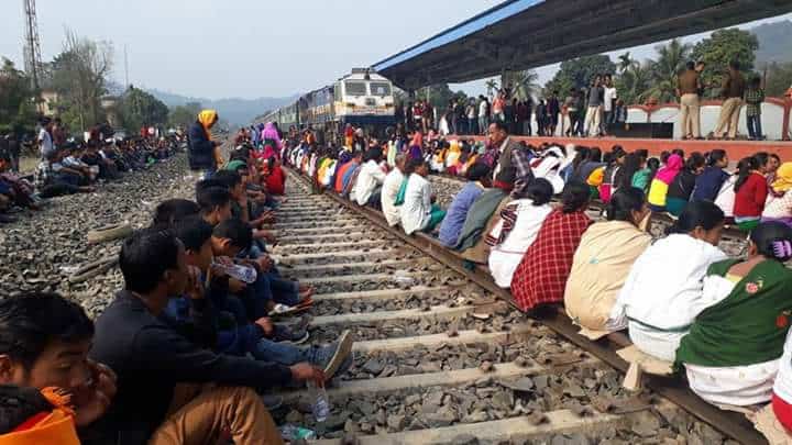
Mizoram Internal Boundary Clashes
As the creation of Nagaland, Meghalaya, Arunachal Pradesh, and Mizoram got underway; the internal boundaries were also created which were not flawless in practical geography mode. This led to internal boundary clashes.
The law and order keepers were a colonial development and legacy. The first ones evolved in the Nagaon District. The later development included the Jorhat or the Shan Militia and later the frontier police leading to formation of the Cachar levy and Assam rifles.
In the interest of keeping the internal boundary issues, it is very sad to reflect on how the state police forces were pitted against each other in the past and in the recent past. But to understand them, do not say adieu to the peculiar geopolitics of the area.

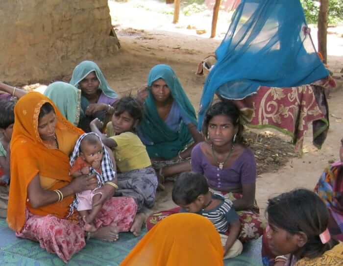
International border village residents, near India Bangladesh Border wait for the international border gate to open, to enter Indian territory, to return their abodes with their cattle in the evening at Dhubri district, known as ‘Cattle Corridor’ in Indian Assam State sector. Photo: Shib Shankar Chatterjee/COROFLOT/NewsBlaze

